Issyk Kul District (Ysyk-Köl)
Issyk-Kul District (Ысык-Көл району, Isıq-Köl rayonu, ىسىق-كۅل رايونۇ; Иссык-кульский район, Issyk-kuljskij rajon) is a district of Issyk-Kul Region in north-eastern Kyrgyzstan. The seat lies at Cholpon-Ata. Its area is 3603 km2, and its resident population was 84,876 in 2021.
The district is located on the northern shore of Issyk-Kul and on the southern slopes of the Küngöy Ala-Too Range, which dominate much of the landscape. The topography varies from multiple-folded medium-altitude mountains featuring in erosional dissection to alluvial - proluvial planes with river fans, river valleys, intermittent water streams, and lakeside planes of Issyk-Kul lake area. Approximately 78% of the district is occupied by mountains, and 22% - by valleys. The hydrological conditions are dominated by rivers Toru-Aygyr with peak flood of 30 m/s, Orto Taldy-Bulak - 6.5 m/s, Chong Taldy-Bulak - 7 m/s, Cholpon-Ata - 20 m/s, Dyure-Suu - 15 m/s, Kichi Ak-Suu - 10 m/s, Orto Koy-Suu - 10 m/s, Orto Oryuktyu - 10 m/s, Chong Oryuktyu - 20 m/s, Chet Baysoorun - 15 m/s, and Cong Baysoorun - 20 m/s.
The district is located on the northern shore of Issyk-Kul and on the southern slopes of the Küngöy Ala-Too Range, which dominate much of the landscape. The topography varies from multiple-folded medium-altitude mountains featuring in erosional dissection to alluvial - proluvial planes with river fans, river valleys, intermittent water streams, and lakeside planes of Issyk-Kul lake area. Approximately 78% of the district is occupied by mountains, and 22% - by valleys. The hydrological conditions are dominated by rivers Toru-Aygyr with peak flood of 30 m/s, Orto Taldy-Bulak - 6.5 m/s, Chong Taldy-Bulak - 7 m/s, Cholpon-Ata - 20 m/s, Dyure-Suu - 15 m/s, Kichi Ak-Suu - 10 m/s, Orto Koy-Suu - 10 m/s, Orto Oryuktyu - 10 m/s, Chong Oryuktyu - 20 m/s, Chet Baysoorun - 15 m/s, and Cong Baysoorun - 20 m/s.
Map - Issyk Kul District (Ysyk-Köl)
Map
Country - Kyrgyzstan
 |
 |
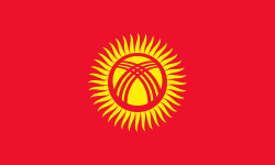
| Flag of Kyrgyzstan | |
Ethnic Kyrgyz make up the majority of the country's 6.6 million people, followed by significant minorities of Uzbeks and Russians. The Kyrgyz language is closely related to other Turkic languages.
Currency / Language
| ISO | Currency | Symbol | Significant figures |
|---|---|---|---|
| KGS | Kyrgyzstani som | Ñ | 2 |
| ISO | Language |
|---|---|
| KY | Kirghiz language |
| RU | Russian language |
| UZ | Uzbek language |


